Cacheu (Cacheu Sector)
Cacheu is a town in northwestern Guinea-Bissau, lying on the Cacheu River. Its population was estimated to be 9,849.
The town of Cacheu is situated in territory of the Papel people. The name is of Bainuk origin: "i.e. Caticheu, meaning 'the place where we rest'."
Founded in 1588, Cacheu was one of the earliest European colonial settlements in sub-saharan Africa, due to its strategic location on the Cacheu river. Cacheu developed a European/Afro-European population from the late fifteenth century through informal settlement of Cape Verdian and Portuguese traders, adventurers and outcasts (lançados). The authorities in mainland Portugal also sent to Cacheu degredados - people condemned to exile for a variety of offences.
For most of the seventeenth and eighteenth centuries, Cacheu was the official slave trading point for the Portuguese in the Upper Guinea region - the point at which the Portuguese crown endeavoured to ensure that duties on all slaves exported were paid. Multiple companies were established to facilitate the trade of slaves from Cacheu to the New World, including that of the Company of Cacheu and Rivers and Commerce of Guinea.
Notable buildings in Cacheu include the Portuguese-built 16th century fort, dating from the period when Cacheu was a centre for the slave trade.
Map - Cacheu (Cacheu Sector)
Map
Country - Guinea-Bissau
 |
 |
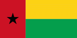
| Flag of Guinea-Bissau | |
Guinea-Bissau was once part of the kingdom of Kaabu, as well as part of the Mali Empire. Parts of this kingdom persisted until the 18th century, while a few others were under some rule by the Portuguese Empire since the 16th century. In the 19th century, it was colonised as Portuguese Guinea. Portuguese control was restricted and weak until the early 20th century with the pacification campaigns, these campaigns solidified Portuguese sovereignty in the area. The final Portuguese victory over the remaining bastion of mainland resistance, the Papel ruled Kingdom of Bissau in 1915 by the Portuguese military office Teixeira Pinto, and recruited Wolof mercenary Abdul Injai was the event to solidify mainland control. The Bissagos, islands off the coast of Guinea-Bissau, were officially conquered in 1936, ensuring Portuguese control of both the mainland and islands of the region. Upon independence, declared in 1973 and recognised in 1974, the name of its capital, Bissau, was added to the country's name to prevent confusion with Guinea (formerly French Guinea). Guinea-Bissau has a history of political instability since independence, and only one elected president (José Mário Vaz) has successfully served a full five-year term. The current president is Umaro Sissoco Embaló, who was elected on 29 December 2019.
Currency / Language
| ISO | Currency | Symbol | Significant figures |
|---|---|---|---|
| XOF | West African CFA franc | Fr | 0 |
| ISO | Language |
|---|---|
| PT | Portuguese language |


